Topic is related to success in ArcIMS implementation.
Links:
Download Presentation
no file attachments
Topic is related to success in ArcIMS implementation.
Links:
Download Presentation
no file attachments
ESRI Business Analyst was used to extract ~1,500 census variables for all 25,374 U.S. census designated places.
no links
Files:
census_place1.png
An “art design receptivity” scoring system was created using a formula that took into account household income, education level, family size, density of architects, and presence of competitor outlets per zip code.
Choropleth maps showing the resulting scores were made of the 25 largest business districts in the United States; the Washington, D.C. map is pictured below.
no links
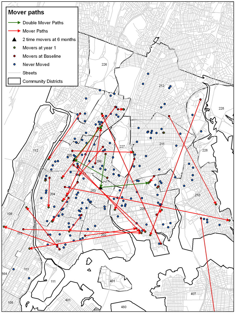
The research question for this study is does one’s neighborhood environment make one more susceptible to Asthma attacks? A set of Asthma patients addresses for New York City was geocoded. Environmental conditions such as proximity to major roads and amount of tree canopy were calculated. Patients were monitored for 18 months at 6 month intervals. Patients that moved were tracked to determine if there was a pattern.
no links
Files:
movers_sm1.jpg
Poster presentation on the 27th ESRI International Conference, San Diego, CA. June 18-22, 2007.
Links:
View the poster
no file attachments
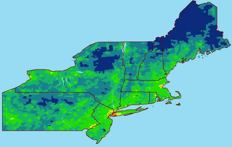
Zip code information for Indian Physicians practicing in the northeastern U.S. was obtained and geocoded. A thematic map displaying high concentrations of Indian physicians in red ranging to low concentrations in blue was created (below).
no links
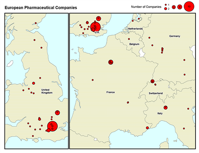
Proportional symbol maps were made showing European pharmaceutical and biotech headquarter locations.
no links
Files:
european_biotech_companies_updated.png
european_pharmaceutical_companies2_resized.png
Topic is related to success in ArcIMS implementation.
Links:
Download Presentation
no file attachments
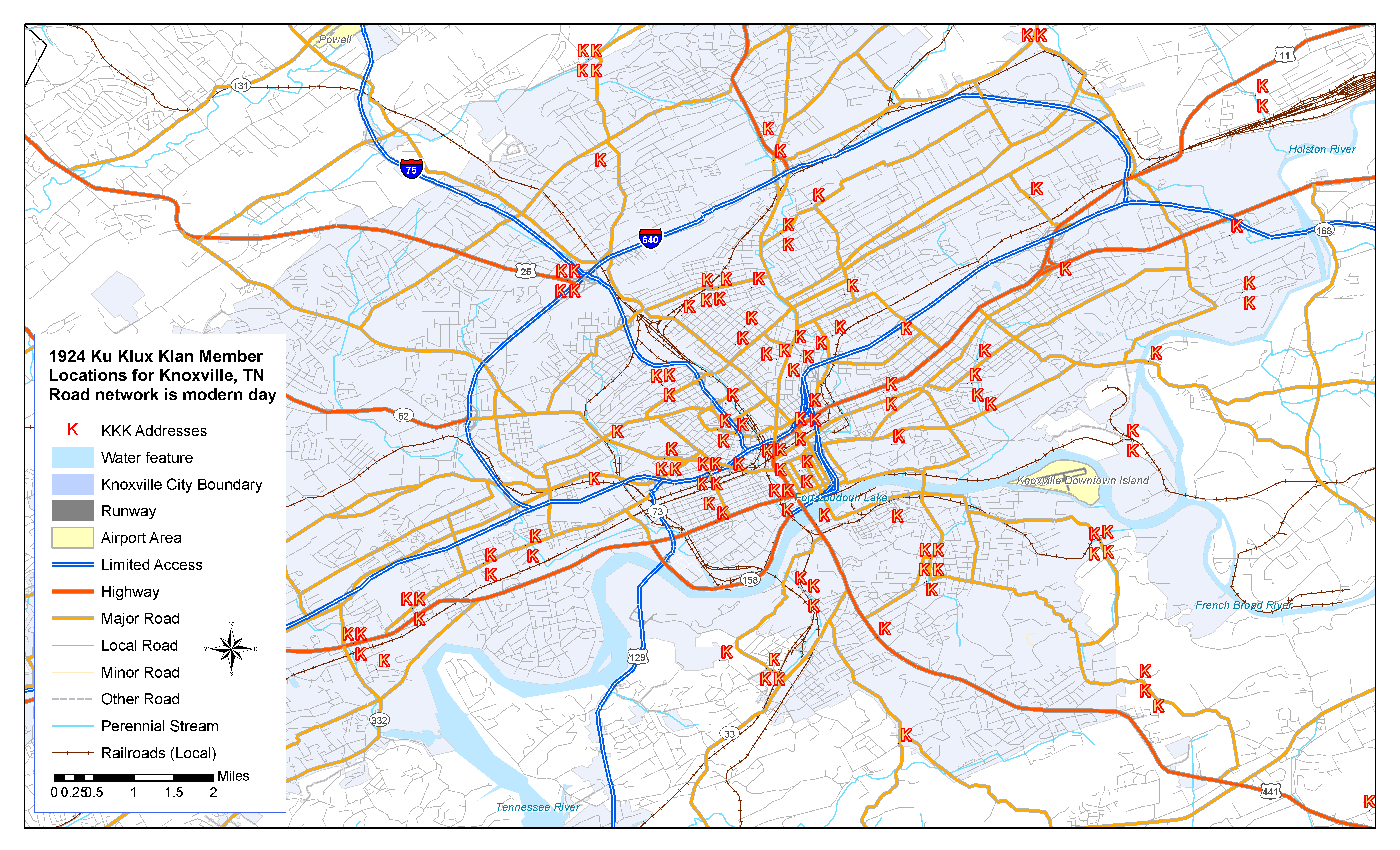
Historical KKK addresses were geocoded in various cities to analyze clustering or proximity to certain landforms / features.
no links
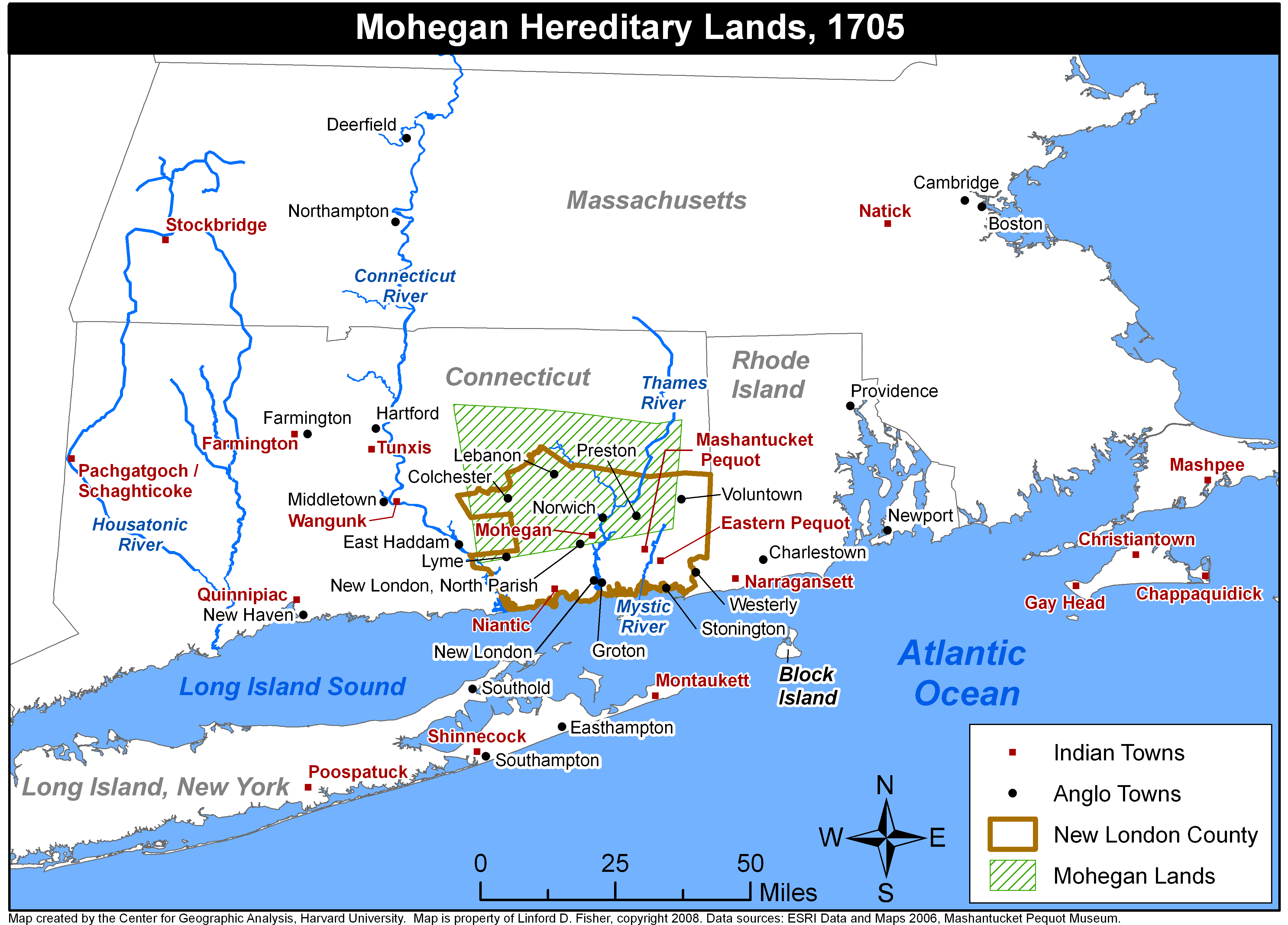
CGA made maps for a doctoral dissertation on Native Americans in New England in the 18th century.
no links
Files:
ne_18th_c1.png