Geoprivacy and Its Impact on Spatial Analysis
A presentation via video conference by Mayra A. Zurbarán
PRESENTATION SLIDES (PDF) AUDIO RECORDING (MP3)
Noon - 1:30, CGIS South Building, Room S354
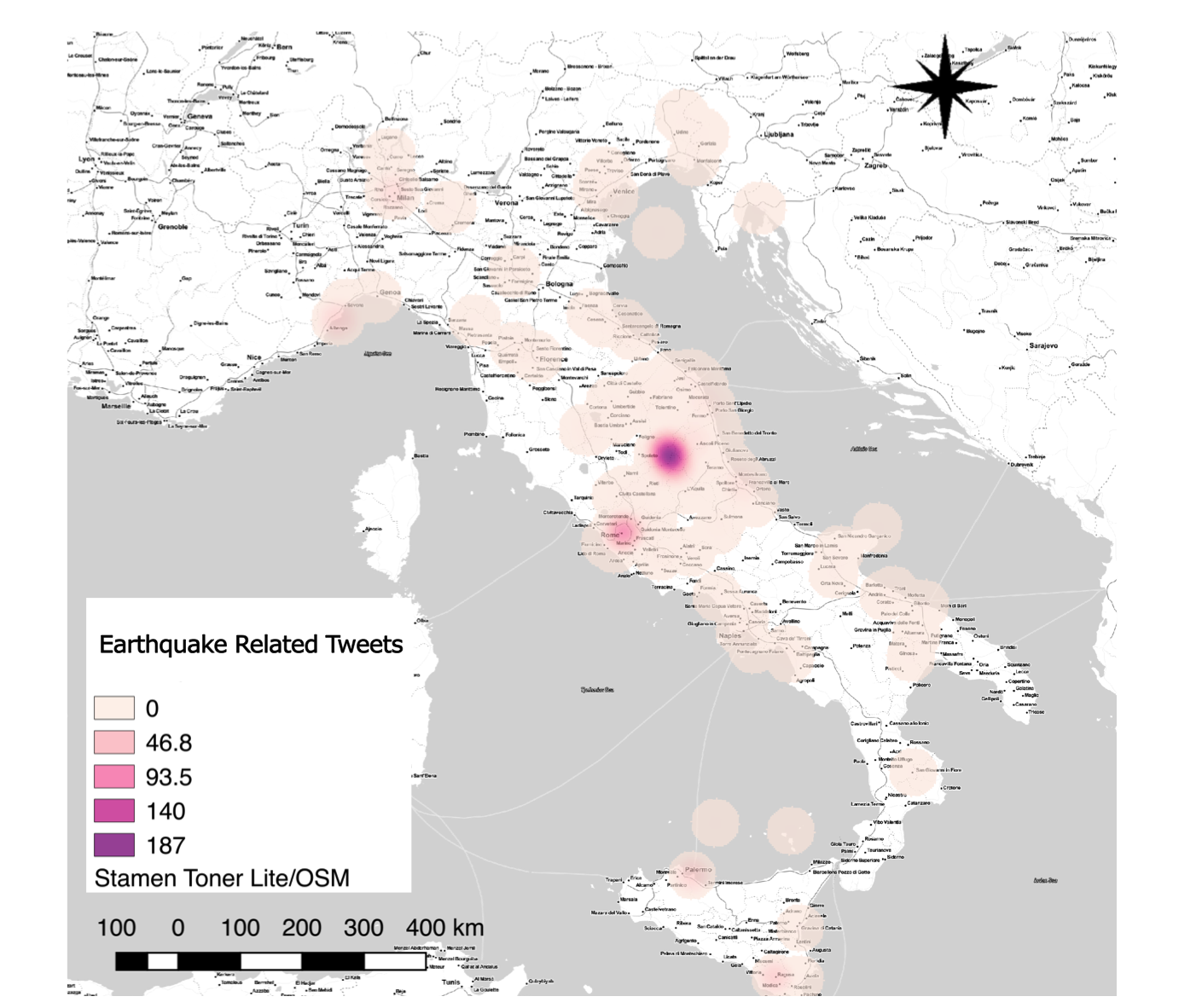
Abstract: Location privacy or geoprivacy is critical to controlling access to user’s information in context-aware applications. Location-based services pose privacy risks for users, due to the inferences that could be made about them from their location information and the potential misuse of this data by providers or third-party companies. This led to the creation of many location privacy protection mechanisms that imply trade-offs between privacy, quality of service and quality of information; being the last one a valuable asset for commercial and research purposes. For assessing the impact of location obfuscation or masking algorithms on Exploratory Spatial Data Analysis (ESDA), it is proposed a comparison using kernel density maps and hotspot analysis with geolocated tweets collected in Italy through the Streaming API and the resulting obfuscated data after applying obfuscation algorithms. Results show that the configuration settings for the privacy algorithms, as well as for the performance analysis, are critical to guarantee an adequate balance between protection and quality of the information.
This talk will discuss location privacy protection mechanisms and their different
purposes in location-based services; focusing on masking techniques to assess and minimize their impact on spatial analysis.
Bio: Mayra is a Ph.D student in Computer Science at the Universidad del Norte in Baranquilla, Columbia. Her research focuses on humanitarian causes, ethical management of data and Geographic Information Systems (GIS).
Lunch will be served.
no links
Files:
itaearthquake.png