The ROAD data includes election returns, socioeconomic summaries, and demographic measures of the American public. It includes every election at and above State House, along with party registration and other variables, in each state for the roughly 170,000 precincts nationwide. The geographic unit of ROAD is based on the Census Bureau defined Minor Civil Divisions (MCD).
There are 47,173 MCDs, completely tile the U.S. land mass. For each MCD, the ROAD collection provides all electoral data aggregated from the precinct level (roughly 30-40 variables), as well as 3,725 variables from the U.S. Census long form. This is the smallest level of aggregation at which publicly-available census data and electoral data can be made to coincide.
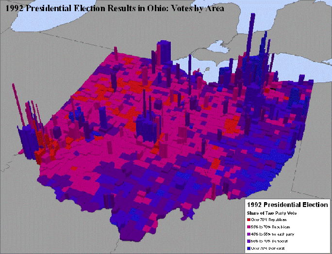
Investigating Spatial Patterns and Analyzing the Correlates of Voting Behavior: Comparison of Voter Turnout to Population Density in Cleveland Metropolitan Area
Analysis of Election Results
no links
Files:
road_5_01.gif