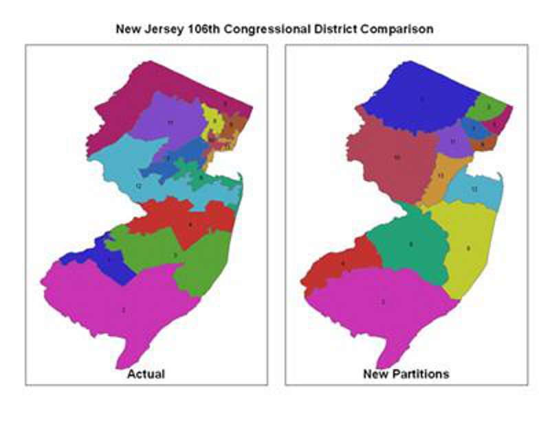
The CGA created maps of actual and hypothetical congressional districts for comparison. The maps of actual districts use the 106th Congressional District Boundaries obtained from the U.S. Census Bureau. The maps of hypothetical congressional districts are generated from lists of coordinate pairs provided by the researchers. Each coordinate pair is intended to represent a Census Block Group centroid.
A procedure was written to automate the process of parsing the text files containing the hypothetical redistricting points, plotting the points as ArcGIS shapefiles and subsequently generating thiessen polygon shapefiles. The process also attributed the thiessen polygons with their associated district assignment and generate district layers for map making.
no links