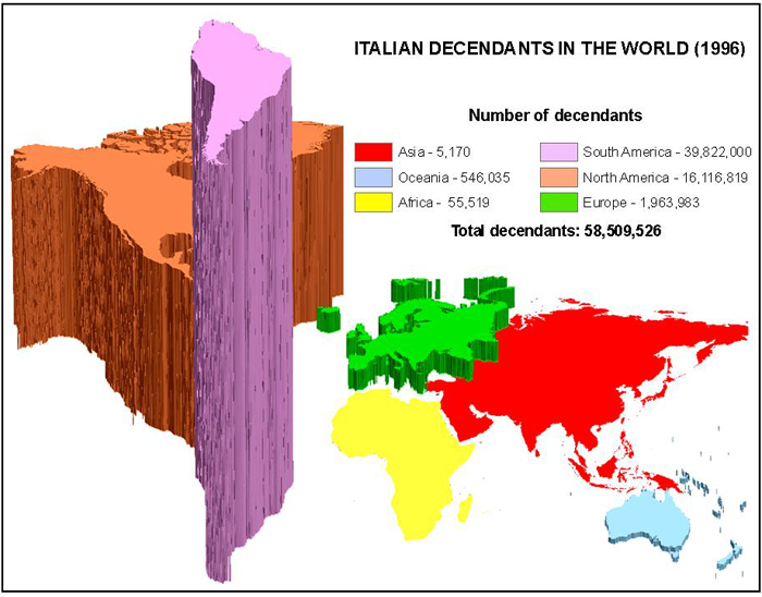
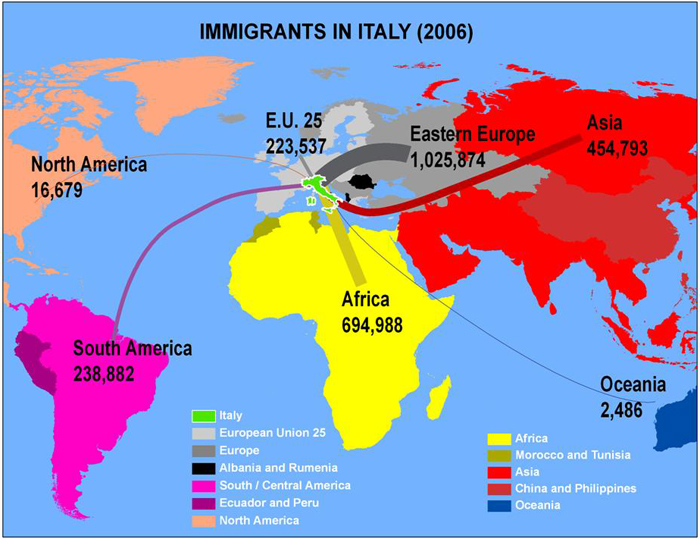
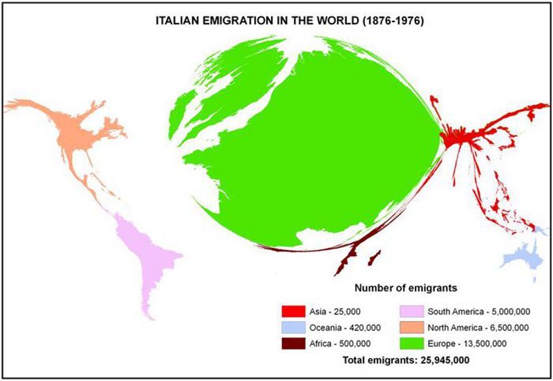
As the point of departure of a massive emigration between the 19th and 20th centuries and the point of arrival of high flows of immigration today, demographic data concerning Italy’s migrations lends itself to a geographical visualization on such a global scale. To better emphasize the differences in the continental scale data, three cartographic techniques were used: cartogram, 3D extrusion, and line thickness weighting. To see a poster presentation containing more detail of this project: Italian Migration Poster.
no links
Files:
italian_decendants1.jpg
italian_immigrants1.jpg
italian_emigration_resized.jpg