CENTER FOR GEOGRAPHIC ANALYSIS NEWSLETTER
April 2012
*
HIGHLIGHTS
Cartography Workshop on May 3rd
SpatiaLABS
Site License Options for Remote Sensing
GIScience 2012 – Abstract Deadline 5/4
UCGIS/USGS Conference on Geospatial Semantics
CyberGIS 2012 Conference
Big Data for GIS and Geography - Article
The “Big Data Initiative” Funding Opportunities
Tufts Library Uses GIS for Resource Planning and Facility Management
Satellite Mapping Coordination System Launched
Visualizing Emancipation Web Application
GeoTrellis: Open Source Geoprocessing Engine for High Performance
Water Risk Atlas
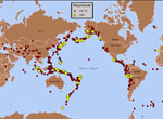
Mexico Drug War Map
PostGIS 2.0 Released
Warmest U.S. Month of March on Record - Video
Bathymetry Survey Map
The Center for Spatial Law and Policy
HTML5 For Map Visualization
ArcBruTile – Tile Services in ArcGIS Desktop
Mean Center Population for the U.S. Map
**
CGA NEWS
Cartography Workshop on May 3rd
This full-day hands-on workshop focuses on the visual representation of geographic information, and will teach the fundamentals and conventions of reference cartography, statistical thematic cartography, and the use of GIS to generate visual representations of spatial information. The cost is $25 and includes lunch.
Date: Thursday, May 3, 2012
Location: Room B-09 of the Science Center
For more information and to register: http://bit.ly/H0wAe7
SpatiaLABS
Offered by ESRI Press, SpatiaLABS are stand alone computer lab activities that introduce, develop, and reinforce spatial reasoning and analysis skills. More on this product here: www.esri.com/spatialabs
The CGA is considering purchasing this collection of classroom GIS lab exercises for use by any Harvard affiliate. Please let us know if you are interested in using this product by emailing: contact@help.cga.harvard.edu
Site License Options for Remote Sensing
CGA is evaluating the need for adding a site license for ENVI, which is remote sensing image processing software. One option is to replace Idrisi with ENVI due to the low usage of Idrisi. If you use either of these software packages for your Harvard related teaching or research, please email contact@help.cga.harvard.edu to let us know which product you prefer. We will continue to maintain ERDAS Imagine site license.
**
CONFERENCES AND EVENTS
GIScience 2012 – Abstract Deadline 5/4
This conference on Geographic Information Science will be held September 19 – 21 in Columbus, Ohio. The deadline to submit abstracts is May 4, 2012
To submit an abstract and register: http://giscience.org/register.html
The conference main page: http://giscience.org/index.html
UCGIS/USGS Conference on Geospatial Semantics
A special optional feature preceding the 2012 University Consortium for GIS Symposium “Building GIScience 2.0” in Washington, D.C., will be a pre-Symposium workshop on Geospatial Semantics, led by staff from the U.S. Geological Survey. The pre-symposium will be held on May 29th, to be followed by the symposium on May 30 – June 1.
More on the pre-symposium and to register: http://www.ucgis.org/Events/moreinfo.asp?ID=304
More on the UCGIS symposium:
http://www.ucgis.org/symposium2012/schedule.aspx
CyberGIS 2012 Conference
The First International Conference on Space, Time, and CyberGIS (CyberGIS’12) will take place during August 6 - 9, 2012 on the campus of the University of Illinois at Urbana-Champaign, IL, USA. CyberGIS’12 will provide a forum for sharing cutting-edge research, education and training experiences ranging from new theories, methods, and applications of CyberGIS and Space-Time Analysis/Modeling/Synthesis, to related industrial relations and partnerships, and international collaborations. The call for papers deadline for this conference is May 15th.
The conference website: http://www.cigi.illinois.edu/cybergis12/
**
NEWS ON GIS RESEARCH AND SERVICES
Big Data for GIS and Geography - Article
The “Big Data Initiative” Funding Opportunities
Tufts Library Uses GIS for Resource Planning and Facility Management
Satellite Mapping Coordination System Launched
The story: http://www.unitar.org/unosat/node/22/1975
The application: http://www.gdacs.org/
Visualizing Emancipation Web Application
Where men and women became free in the Civil War South.
The story: http://spatialnews.geocomm.com/dailynews/2012/apr/13/news4.html
The application: http://dsl.richmond.edu/emancipation/
GeoTrellis: Open Source Geoprocessing Engine for High Performance
http://www.azavea.com/products/geotrellis
Water Risk Atlas
http://insights.wri.org/aqueduct/atlas
Mexico Drug War Map
http://www.diegovalle.net/drug-war-map.html
PostGIS 2.0 Released
http://postgis.refractions.net/news/20120403/
Warmest U.S. Month of March on Record - Video
http://www.youtube.com/watch?feature=player_embedded&v=JAjjjtDY8UU
Bathymetry Survey Map
http://maps.ngdc.noaa.gov/viewers/bathymetry/
The Center for Spatial Law and Policy
HTML5 For Map Visualization
ArcBruTile – Tile Services in ArcGIS Desktop
http://arcbrutile.codeplex.com/
Mean Center Population for the U.S. Map
http://visual.ly/mean-center-population-united-states-1790-2010
**
Editor of this issue is Jeff Blossom
The CGA Newsletter is published monthly.
For previously published issues please visit: http://gis.harvard.edu/newsletter
For the latest information, please visit our website http://gis.harvard.edu
Unsubscribe information is at the bottom of this page:
no links