By Josh Lieberman, senior research scientist at CGA.
Thursday, December 1, 2016. Noon - 1:30. Room S354, CGIS South building, 1730 Cambridge St.
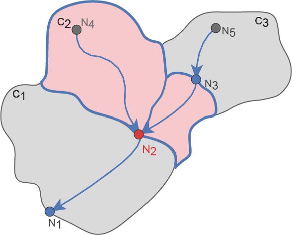
Abstract: Effective spatial data use on the Web means being able to link disparate data elements such as features and geometry across the Web. Spatial data interoperability across the Web requires both a common model and vocabulary of spatial concepts. The presentation will cover a number of vocabularies developed in RDF/OWL to communicate both general spatial concepts and the specific entities involved in the study and mapping of surface water features in the U.S. and elsewhere. Linked data mechanisms and RDF/OWL ontologies allow such data not only to be “webified” and distributed widely, but also fit well with the multi scale and diverse network representations of hydro features. Tools will be covered that enable transformation of relational hydro data into linked data, publication, mapping, and analysis.
Speaker Bio: Josh is a senior research scientist at CGA working on hydrographic ontologies and semantic applications for the U.S. National Map as part of the new Spatiotemporal Innovation Center. He also serves as a coordinating architect and initiative manager for the Open Geospatial Consortium and as a lecturer at the University of Maryland Baltimore County. Josh has a Ph.D. from the University of Washington, M.S. from the University of Oregon, and A.B. from Dartmouth College, as well as many years of experience in earth and environmental sciences and geospatial modeling.
no links
Files:
pastedgraphic-1.jpg