By Keiji Yano (Geography Department and Art Research Center, Ritsumeikan University, Kyoto, Japan)
Noon - 1:30, Room S354 CGIS South Building (1730 Cambridge St.)
This Geography Colloquium is co-sponsored by Reischauer Center for Japanese Studies.
Presentation slides PDF
Video of presentation: YOUTUBE
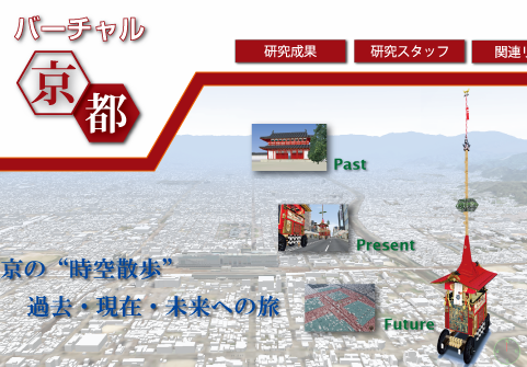
Abstract: Virtual Kyoto is a virtual time-space created on the computer for the purpose of investigating the past, present and future of the historical city, Kyoto. Using the cutting-edge technologies in GIS and VR, we have conducted Virtual Kyoto as a 4D-GIS that comprises a series of 3D-GIS at various points in time. From a viewpoint of Digital Humanities, Virtual Kyoto is an infrastructure to place numerous digitally archived materials associated with the city, and to disseminate Kyoto’s cultural assets to the world over the Internet (Yano et al., 2007; Yano et al. 2011). Virtual Kyoto consists of a wide variety of GIS-based geo-spatial data of Kyoto, whose most important data sources are historical maps and landscape paintings. This talk will explore Virtual Kyoto as historical GIS using some landscape paintings (e.g. Rakuchu rakugai-zu) based on the context of Digital Humanities. http://www.geo.lt.ritsumei.ac.jp/webgis/ritscoe.html
Bio: Prof. Keiji Yano, Professor of Geography and GIS Science at Ritsumeikan University, Kyoto Japan.
Lunch will be served.
no links
Files:
2016-08-10_1125.png