By Peter Damrosch
Room S050, CGIS South Building.
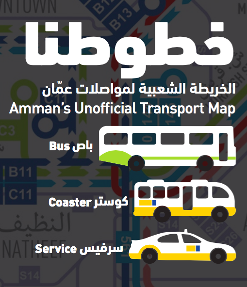
Abstract: There’s little in the way of publicly available information about public transportation in Amman, Jordan. Most people use word of mouth to get around, but in a city that’s grown from 50,000 people to 4 million in just a few decades, word of mouth has its limitations.
I started an initiative to tackle this problem. Our group collected data on Amman’s buses, minibuses, and shared-taxis and came out with the city’s first public transportation map. In this talk, I’ll be exploring a series of questions I’ve encountered. What is the value of open geospatial data and how do you communicate this value? How do you adapt tools and methodologies created in other countries and contexts to fit the needs of a city like Amman? How can you use the development of transportation tools to contribute to the broader geospatial data ecosystem?
I’ll also talk about, and would love to get your feedback on, our latest tool − a trip planner app that uses neighborhoods and landmarks to navigate the city.
Bio: Peter Damrosch has been an affiliate at the Center for Geographic Analysis this past year. Before that, he lived in Jordan for three years where he taught high school history and helped create the country’s first paper transit map. He’s about to return to school for a dual-degree in law and urban planning at MIT and Yale Law School.
no links
Files:
peter-abcdtalk-image.png