Title: A Geospatial Framework For Allocating Disaster Recovery Centers
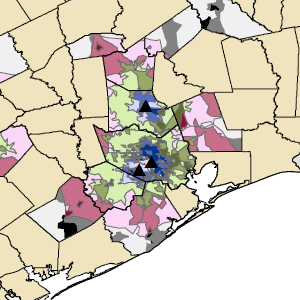
Judges comments: “The analytical part of this project is multi-faceted,and well developed, modeled and documented. Based on the Arcpy 2.7.x module, the Python script created uses network analysis to produce catchment areas for DRC’s, social vulnerability data from the CDC, and utilizes a REST end point query service to obtain the DRC locations from FEMA. It uses additional analytical tool such as zonal statistics and the numpy library. The entire project is well documented and elegantly presented with appropriate maps and graphs.”
Links:
Project Abstract
Project Technical Report
Project Presentation
Files:
drc2.png