The explosion that took place August 12th at the Tianjin Ruihai Logistics facility shocked the world. The force of the explosions were equivalent to small earthquakes, and the fireball that erupted from the site was visible from space. In today’s New York Times, there is a remote sensing image that is designated as the site of Ruihai Logisitics, with several buildings marked on it, including the “Hazardous materials storage” buildings. 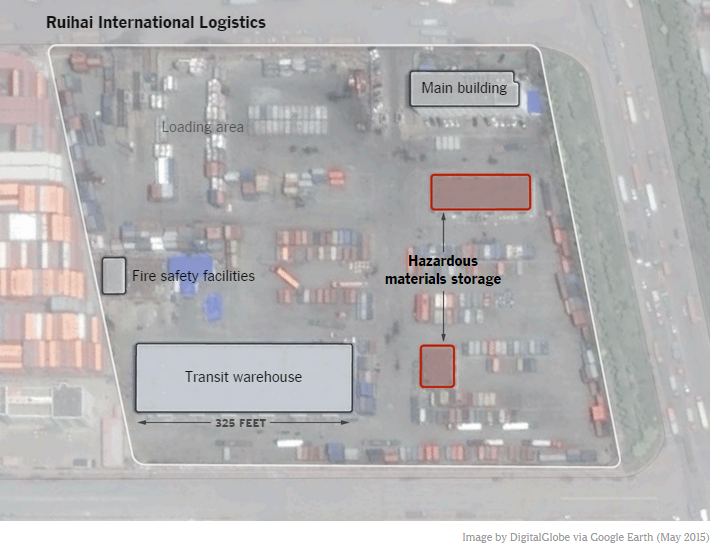 However, except for knowing that this took place in the Free Trade Zone of Binhai Disctict, Tianjin City, there is no specific information to pinpoint where the explosion occurred. Looking at the Port of Tianjin Planning Map provides a view of the area, but without any details to identify the exact location.
Below are a series of maps to provide geographic context, zooming in from the Beijing and Tianjin Region to the Binhai District of Tanggu Port, and to the actual site, which I was able to match to the remote sensing image published in the New York Times.
This is merely provided to help picture the location more accurately for those concerned about this tragic event.
Here are the coordinates which I believe pinpoint the explosion site: 39.0389064,117.737284
Also, here is the Google Plus Code for the site, which will load in Google Maps: http://plus.codes/8PFV2PQP+HW
Map One
This regional map shows the Northeast part of China facing the Bohai Sea. Using OpenStreetMap Transport basemap for clarity.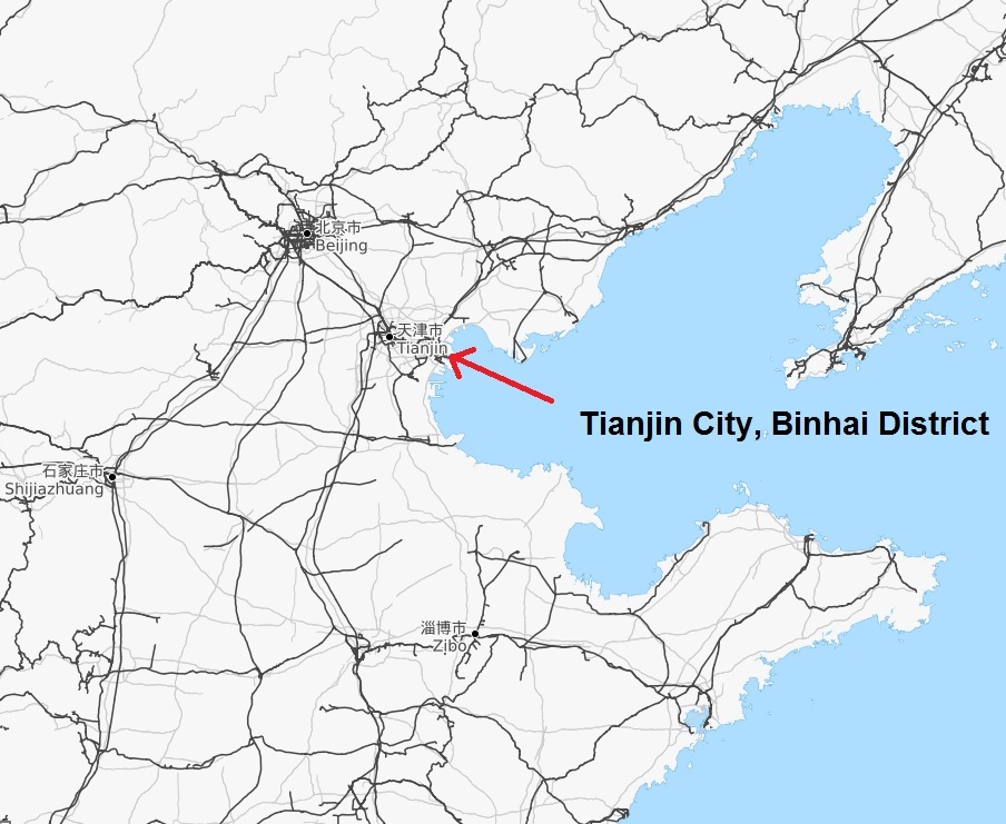
Map Two
This greater city map of Tianjin shows Tanggu Port and the Binhai district on the coast. 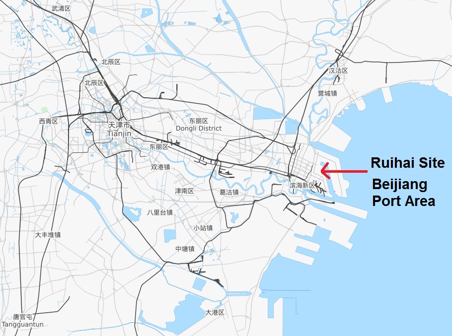
Map Three
This zoomed in view of the Binhai District shows the Beigangchi (or Northern Harbor Basin) between Beijiang Port Area and Dongjiang Port Area. 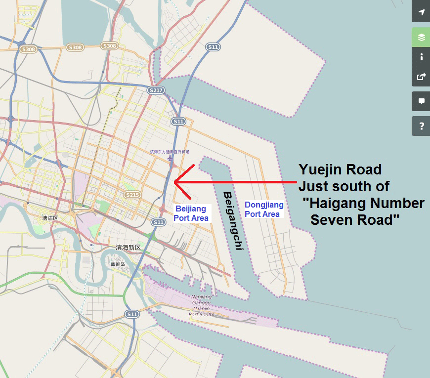
Map Four
Moving to the Google satellite map, we can now match the actual Ruihai Logistics site to the surrounding roads in the Beijiang Port Area, just west of the Beigangchi Inlet. 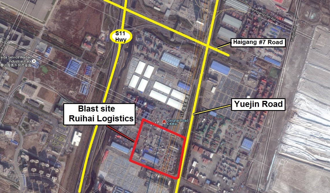
Map Five
Finally, we can match the actual buildings that were identified in the Digital Globe analysis seen in the New York Times image. 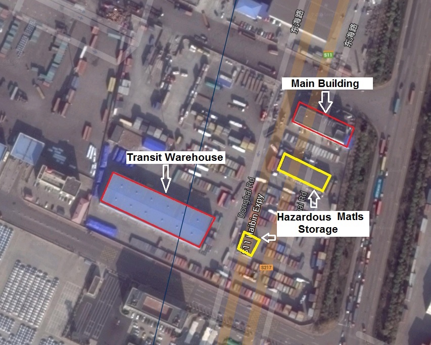
Map Six
Here they are side by side.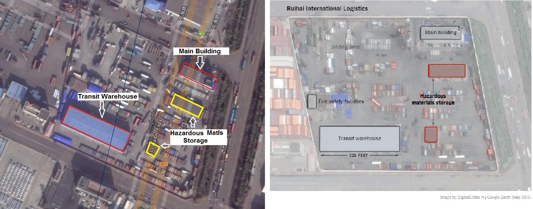
[Lex Berman, 2015-08-13]
no links
no file attachments