In response the 7.8 Magnitude earthquake that struck Nepal, we are gathering information for anyone interested in the response by the larger geospatial community. This response falls into several categories, such as: emergency mapping, geographic information about the quake, publishing and distribution of geographic datasets and imagery for analysis. We will provide links to the main resources in these categories and also try to outline the current steps being taken within the CGA and the Harvard community on this webpage.
Publications
Disaster response: volunteers unite! Letter published in SCIENCE (2015-08-14) vol. 349 no. 6249 p.699
Events at Harvard
Harvard South Asia Institute hosted the forum: Consequences and Responses: Lessons From and For Nepal (May 14th).
Mapathon for Nepal brought together volunteers from the GSD and CGA, as well as from Tufts, UMass Boston, Harvard Kennedy School Masters in Public Policy, Harvard T. H. Chan School of Public Health, GeoAdaptive LLC, the local Nepali community. (May 12th)
Webcast: Humanitarian Response to the Crisis in Nepal (May 7th) [1hr 2m]
Emergency Mapping
Nepal Govt Earthquake Relief Portal
Google Nepal Resources
Kathmandhu Living Labs blog updates of live incident reporting
National Geographic describes crisis mapping efforts for Nepal
Open Street Map call for volunteer mappers
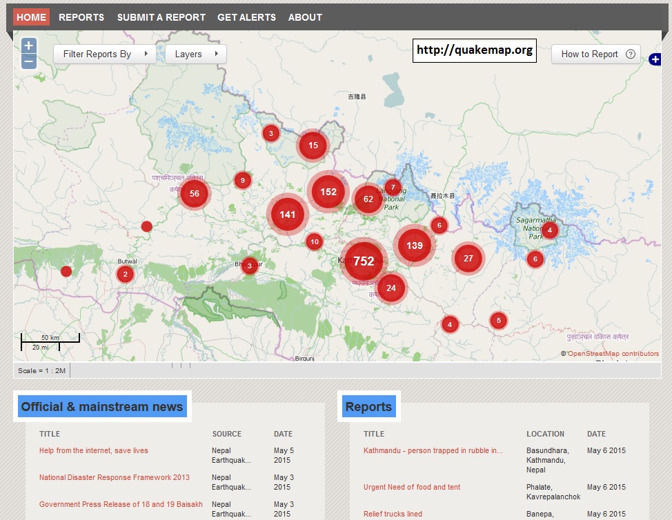
QuakeMap.org aggregates real-time SMS messages
UNOSAT GDACS Damage Assessment site photos and dynamic maps
Geographic Information and Overview of the Earthquake
IRIS Seismology Overview with Maps, Charts and Figures
New York Times report on the extent of damage and casualties
New York Times Before and After photos of historic sites
Open Street Map Nepal Earthquake Overview
Relief Web situation reports and continuous updates
USGS Earthquake Report Nepal April 25th 2015
Washington Post non-technical overview with diagrams and maps
Geographic Data Sharing
HDX Nepal Earthquake data repository
U.N. Spider Imagery Data List
Harvard Community
CGA Nepal Tweetmap CGA has made the geotweets for the impacted area surrounding the Earthquake viewable, searchable and downloadable by day, on WorldMap. You can search by any language, zoom in and click on the dots to see content of individual tweets. By changing the background map to Google Satellite or other images and you may see even the buildings where these tweets are generated from.
Graduate School of Design Nepal Quake Aid website
South Asia Institute Harvard for Nepal
Harvard Crimson report Harvard Responds
no links
Files:
quakemap-org.jpg