Historical GIS and Digital Humanities based on Virtual Kyoto

By Keiji Yano (Geography Department and Art Research Center, Ritsumeikan University, Kyoto, Japan)

Noon - 1:30, Room S354 CGIS South Building (1730 Cambridge St.)

This Geography Colloquium is co-sponsored by Reischauer Center for Japanese Studies.

Presentation slides PDF

Video of presentation:  YOUTUBE

Abstract: Virtual Kyoto is a virtual time-space created on the computer for the purpose of investigating the past, present and future of the historical city, Kyoto. Using the cutting-edge technologies in GIS and VR, we have conducted Virtual Kyoto as a 4D-GIS that comprises a series of 3D-GIS at various points in time. From a viewpoint of Digital Humanities, Virtual Kyoto is an infrastructure to place numerous digitally archived materials associated with the city, and to disseminate Kyoto’s cultural assets to the world over the Internet (Yano et al., 2007; Yano et al. 2011). Virtual Kyoto consists of a wide variety of GIS-based geo-spatial data of Kyoto, whose most important data sources are historical maps and landscape paintings. This talk will explore Virtual Kyoto as historical GIS using some landscape paintings (e.g. Rakuchu rakugai-zu) based on the context of Digital Humanities. http://www.geo.lt.ritsumei.ac.jp/webgis/ritscoe.html

Bio: Prof. Keiji Yano, Professor of Geography and GIS Science at Ritsumeikan University, Kyoto Japan.

Lunch will be served.

no links

Files:
2016-08-10_1125.png
Share

Normalized Difference Vegetation Index (NDVI)

The following data (size: 20GB) is available in the HMDC computer lab in CGIS Knafel K026 (T:\Esri_Data_2016). It may be copied to a local or network hard drive, used in the lab, or mapped using the path \fas-depts.ad.fas.harvard.edu\cgis\arcgis (it requires the fas_domain account login).

  • Esri 2016 -2021 Updated Demographics
  • Esri 2016 Tapestry
  • Esri 2016 Consumer Spending
  • 2010 Census (Updated 2016)
  • 2010 -2014 American Community Survey

The data is for educational use only, and is presented in file geodatabase format at all levels of geography (state, county, census tract, block group, place, and ZIP code), for the entire U.S., and can be used in ArcGIS for Desktop, ArcGIS for Server, or other display/analysis software. read more

Links:
NDVI

no file attachments

Share

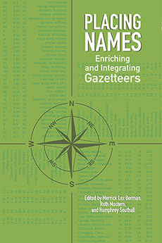
Placing Names - Enriching and Extending Gazetteers

Placing Names discusses the evolution and construction of gazetteers and how they can be used to model our conceptions of historical places,  as well as how those places change over time

This volume brings together leading and emergent scholars to examine the history of the gazetteer, its important role in geographic information science, and its use to further the reach and impact of spatial reasoning into the digital age.

Indiana University Press,  The Spatial Humanities Series

Publication date: 8/4/2016    Format: cloth 280 pages, 40 b&w illus., 10 maps, 11 tables

ISBN: 978-0-253-02244-8      ORDER ONLINE

Contents:

Preface / Peter K. Bol
Introduction / Ruth Mostern, Humphrey Southall, and Merrick Lex Berman

Section 1: What is a Gazetteer
1. Gazetteers Past: Placing Names from Antiquity to the Internet / Ruth Mostern and Humphrey Southall
2. Gazetteers Present: Spatial Science and Volunteered Geographical Information / Michael F. Goodchild
3. Gazetteers Global: United Nations Geographical Names Standardization / Helen Kerfoot
4. Gazetteers Enriched: A Conceptual Basis for Linking Gazetteers with Other Kinds of Information / Ryan Shaw

Section 2: Using Gazetteers in Combination
5. International Standards for Gazetteer Data Structures / Raj Singh
6. Place, Period, and Setting for Linked Data Gazetteers / Karl Grossner, Krzysztof Janowicz, and Carsten Keßler
7. The Pleiades Gazetteer and the Pelagios Project / Rainer Simon, Leif Isaksen, Elton Barker, and Pau de Soto Cañamares
8. Historical Gazetteer System Integration: CHGIS, Regnum Francorum, and GeoNames / Merrick Lex Berman, Johan Åhlfeldt, and Marc Wick

Section 3: Exemplars
9. Building a Gazetteer for Early Modern London, 1550-1650 / Janelle Jenstad
10. Digitally Exposing the Place Names of England and Wales / Paul Ell, Lorna Hughes, and Humphrey Southall
11. Standardizing Names Nationally: The Work of the United States Board on Geographic Names / Michael Fournier
12. The Yeosi Project: Finding a Place in Northeast Asia Through History / Youcheol Kim, Byungnam Yoon, Jonghyuk Kim, and Hyunjong Kim

Section 4: Doing History with Gazetteers
13. Mapping Religious Geographies in Chinese Muslim Society / Mark Henderson and Karl Ryavec
14. Core-Periphery Structure of the Nobi Region, Central Japan, With Reference to the Work of G. William Skinner / Tsunetoshi Mizoguchi
15. Gazetteer GIS and the Study of Taiwan Local Society and its Transition / Pi-ling Pai and I-Chun Fan

no links

no file attachments

Share

Mapping Amman’s Public Transportation System

By Peter Damrosch

Room S050, CGIS South Building.

Abstract: There’s little in the way of publicly available information about public transportation in Amman, Jordan. Most people use word of mouth to get around, but in a city that’s grown from 50,000 people to 4 million in just a few decades, word of mouth has its limitations.

I started an initiative to tackle this problem. Our group collected data on Amman’s buses, minibuses, and shared-taxis and came out with the city’s first public transportation map. In this talk, I’ll be exploring a series of questions I’ve encountered. What is the value of open geospatial data and how do you communicate this value? How do you adapt tools and methodologies created in other countries and contexts to fit the needs of a city like Amman? How can you use the development of transportation tools to contribute to the broader geospatial data ecosystem?

I’ll also talk about, and would love to get your feedback on, our latest tool − a trip planner app that uses neighborhoods and landmarks to navigate the city.

Bio: Peter Damrosch has been an affiliate at the Center for Geographic Analysis this past year. Before that, he lived in Jordan for three years where he taught high school history and helped create the country’s first paper transit map. He’s about to return to school for a dual-degree in law and urban planning at MIT and Yale Law School.

no links

Files:
peter-abcdtalk-image.png

Share

Introduction to GIS

This course introduces the concepts and components of a geographic information system (GIS). It also teaches the essential skills of operating a functional GIS through the use of ArcGIS software package. By completing this course, students will understand the operational processes of spatial data acquisition, editing and QA/QC, metadata development, geodatabase design, spatial query and display, spatial analysis and modeling, preliminary GIS application development, cartographic mapping and dynamic visualization, and GIS implementation basics. Students will also be exposed to Google Earth and common open source GIS tools, as well as the basic concepts of remote sensing and Global Positioning System (GPS).

GIS technology has broad applications in natural and social sciences, humanities, environmental studies, engineering, and management. Examples include wildlife habitat study, urban and regional planning, contagious disease monitoring, agriculture and forestry, environmental quality assessment, emergency management, transportation planning, consumer and competitor analysis, and many more. This course will introduce a few selected cases of GIS application in different disciplines.

To register please go here.

no links

no file attachments

Share

Spatial Analysis and Representation

Urban planners engage in many complex processes that defy easy representation. This course provides first-semester urban planning students with the graphic and technical skills needed to reason, design and communicate these processes with geospatial data. This knowledge will be embedded within a larger critical framework that addresses the cultural history of categorization, data collection and cartography as tools of persuasion for organizing space.Visual expression is one of the most compelling methods to describe the physical environment, and students will learn techniques specifically geared towards clarifying social, political and economic dynamics and how they relate the structuring of spaces. The class will introduce fundamentals of data collecting, data formatting and data importing into a Geographic Information System (GIS) environment.Students will gain familiarity with the technical tools essential to GIS for making maps and exploring relationships in the physical, regulatory and demographic dimensions of the landscape. Within GIS, students will learn the basics of geospatial processing to produce new forms of knowledge in support of ideas about urban planning and design. Desktop publishing tools, including Adobe Photoshop, Illustrator, and InDesign will be used to distil ideas into effective graphic presentations. The class will also advance techniques for representing form and space through diagramming and three-dimensional modeling programs.Students will be introduced to workflows that demonstrate how to move effectively between data from these platforms and modes of representation. Class lectures will be complemented with technical workshops.

Objectives:1. Establish a conceptual framework for critically engaging the practices of mapping and data-visualization;2. Provide a basic understanding of tools and techniques needed to reason, design and communicate with geospatial data;3. Develop students’ skill and confidence for visualizing the complex processes, flows, and dependencies unique to the planning discipline.

Prerequisites:Enrollment in the Urban Planning program

Course Website

no links

no file attachments

Share

GeoNode Intro & Demo

An introduction to the GeoNode geospatial data system.  Presented at the Secondary Cities Symposium, Harvard University.    Presentation slides (PDF).

no links

no file attachments

Share

Wrangling Data into Maps - Longwood- Fall 2016

The ability to ‘wrangle’ various forms of data into a GIS is necessary in order to produce maps or analysis. Students will learn how to convert and properly geo-reference raw data in text form into GIS format, find and import relevant publicly available data, and produce a map of the results.

Download Workshop Materials

no links

no file attachments

Share

Basic Introduction to GIS - Longwood - Fall 2016

Brief introduction to GIS, and the CGA workshop training series, to help students determine workshops that are appropriate for their individual needs. Students will use online and desktop GIS software.

Download workshop material!

no links

no file attachments

Share

Making Sense out of Spatial Data - Longwood- Fall 2016

An introduction to spatial analysis for various kinds of problem solving in a GIS environment. Examples of both raster and vector data-based spatial operations like overlay, buffering, and interpolation will be covered.

Location: HMS Countway Library, Room L02-25 Computer Lab

Download Workshop Materials

no links

no file attachments

Share