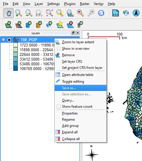
Export Data in Vector GIS formats
- Exporting any GIS data layer that appears in the LAYER LIST is as simple as right-clicking and SAVE AS...
- You will find options under FORMAT for Shapefiles, GeoJSON, KML, GML, MapInfo, AutoCAD DXF, and others.
- Note that you will also be able to set the Encoding and CRS for the export. Although it is often quite simple to convert encodings or CRS with the SAVE AS process, keep in mind that not all character set encodings will be properly handled with the Unicode mapping built in to QGIS, nor will all CRS choices be appropriate. For these types of conversions, you might want do the CRS transform in QGIS to make sure it works, and for character set encodings you might want to use a customized application such as Okapi Rainbow framework outside of QGIS and then join the results back to your spatial data from the converted tabular data files.
|
