Adding Basemaps (Google, OpenStreetMap, Yahoo!, Bing)
using OpenLayers Plugin
revised for 2.4 & 2.6
|
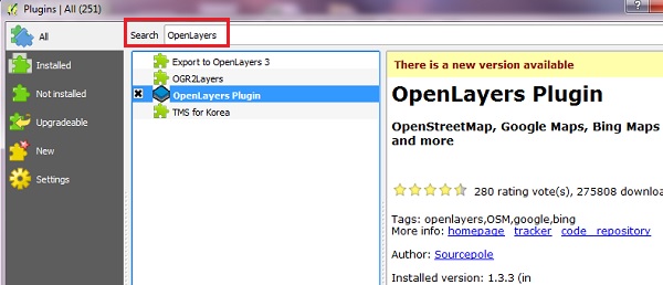
- From the main menu click Plugins -> Manage and Install Plugins
- Start typing the name of the plugin "OpenLayers" in the SEARCH box and the list will be filtered
- OpenLayers should already be installed, as indicated by the checkbox being ticked.
- If you get an error using Open Layers Plugin, Uninstall, then Install a fresh version. To install any plugin, click on the item in the list, then INSTALL PLUGIN button.
- After you see "successfully installed" dialog box, CLOSE the Plugins window.
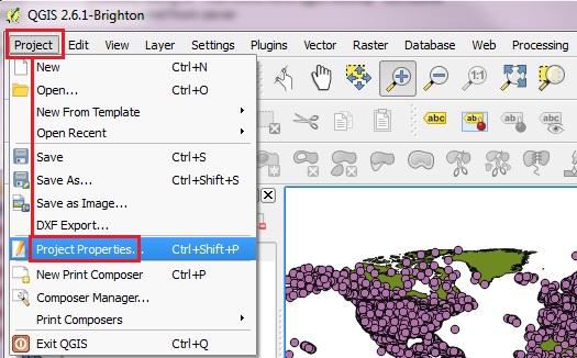
- BEFORE adding your basemap, you must make sure the Projections are set properly.
- From the main menu click Project > Project Properties
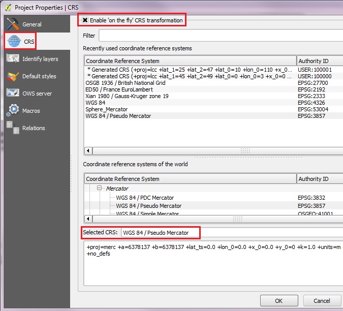
- Click on CRS tab on the left to see the Coordinate Reference System settings.
- Click the Enable ‘on the fly’ CRS transformation check box.
- Type "Pseudo" in the Filter box. From the results select the WGS 84 / Pseudo Mercator (Authority ID EPSG:3857), then click OK to save the changes
- [Note: the previous name: Google Spherical Mercator is no longer valid.]
- Before adding the basemap, let's load two vector layers from workshop_data/part_one folder: continent.shp and airports.shp . Zoom into some area of interest, for example the leeward islands between Venezuela and Haiti.
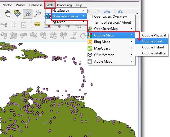
- Now we are ready to add a basemap using OpenLayers plugin.
- Back on the main menu, click Web and then navigate to OpenLayers Plugin -> Google Maps -> Google Streets
- Or you can pick on of the other layers to add, such as OSM or Yahoo choices.
- Click Web from the top menu and -> Open Layers plugins
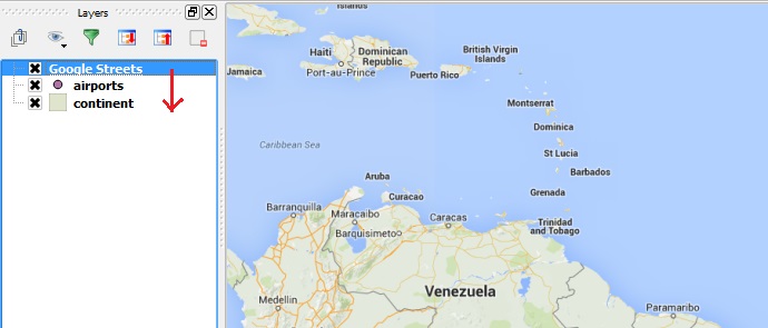
- The basemap will typically appear on the TOP of the drawing order.
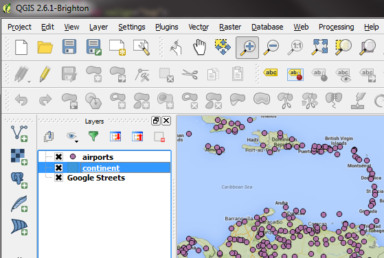
- On the Layers List, click on the Google Satellite layer and DRAG it to the bottom of the stack
- If a polygon layer is ABOVE the Google Streets basemap in the Layer Stack, change its transparency (right click -> Properties -> Style -> Transparency)
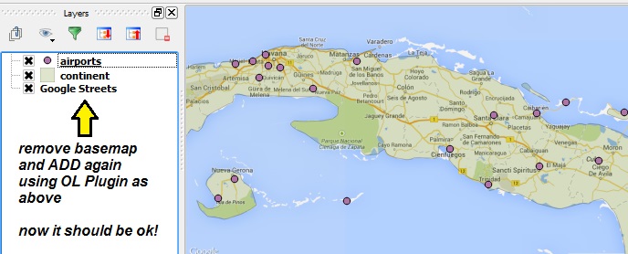
- If you want to experiment with other basemaps, we recommend REMOVING the current OpenLayers basemap from your Layer List FIRST, before adding a new one.
- You can expect the layer to draw on top of the stack, and to require changing the drawing order, etc, for each new basemap test.
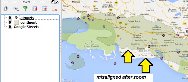
- You might find that the Google Streets layer basemap gets misaligned after zooming in or out.
- To fix this REMOVE the basemap layer, and ADD it again at your new zoom level.
|
